Tuesday 11 June 2013

Epilogue

Monday/Tuesday 10th-1th June
Before leaving William, we stopped off at the depot of the William-Grand Canyon Railway.  Here, before the departure of every train, they stage a shoot out between three baddies and the sheriff.  Needless to say, the sheriff won.  We then went South to Oak Tree Canyon, yet another enormous gash in the edge of the Kaibab Plateau.   Reaching Sedona the temperature had climbed to near 1000F, an we had opted for a ride in the desert in some very tasty pink jeeps!  It was hot, slightly dusty and very bumpy but the seating was very soft and comfortable – just hang on!

Onward to Phoenix but first a stop at Montezuma’s Castle, neither a castle nor anything to do with Montezuma, but and old Indian village built into a cliff overhang beside a river, built about 700 AD, abandoned about 1350. 

Finally, the Scottsdale Hilton and time for a quick swim (1040F) before going to a farewell dinner at Rustler’s Roost, a western-themed beer and beef restaurant.  Good Country and Western music and some of the party amazed the group with very 60’s rock and roll.  Time for a stroll around Scottsdale’s historic centre before lunch at the Fashion Mall (Arndale – eat your heart out) and then an additional four hour’s delay at Phoenix Sky Harbor airport.

We covered 3265 miles.  It was  advertised as “Awesome” and there was awe at least three or four times each day.  The whole trip was a delight, made particularly so by a good crowd (no one lost or injured), a smooth and safe driver, Kelly, and a brilliant Tour Manager, Rob.  While we shall be processing photos and videos for weeks to come, the memories will be unforgettable.  


Grand Finale

Sunday 9th June – From Bryce Canyon, we retraced our steps westward through Red Canyon, where we stopped to photograph spectacular examples of hoodoos.


Then we turned south into the Sevier River valley. There were a few farms and ranches here. Mount Carmel was the birthplace in 1875 of Maynard Dixon, an artist who devoted much of his life to depicting western life and landscapes. On we went down the Virgin River valley towards the town of Kanab. This town boasts of being ‘Little Hollywood’ due to the number of Western movies filmed here.  Just south of Kanab we crossed the border into Arizona.  The red sandstones were still with us. This area is known as the Kaibab Plateau and from Lefevre Viewpoint we could see a landscape feature called the Grand Staircase. This comprises a series of cliffs hundreds of miles long stepping down towards the Colorado Plateau. They are, from the end of Bryce Canyon, the Pink Cliffs, the White Cliffs and the Vermilion Cliffs.  There is nothing comparable on this scale in Britain.

We followed the Vermilion Cliffs (a rich reddish brown) to the Colorado River at Marble Canyon. Here, the Navajo Bridge, finished in 1929, opened up the route south as it one of only two bridges for hundreds of miles.  Across the river we drove through a Navajo Indian reservation and on, via Cameron, to Grand Canyon National Park.

Again, the scale of this park is more than one can imagine. It took a good half-hour to drive from the entrance to the rim area. (It was now  3.00 pm, we had gained an hour in Arizona.) The park boasts a village, visitor centre, geology museum and no less than four shuttle bus routes. It covers a strip of land over 100 miles long. The canyon is a mile deep.

 We had a mere 3.5 hours here and managed to take a short bus ride west, walked along the rim for half a mile, bussed back to Bright Angel and had supper. For me the canyon was overwhelming; the rim walk, 6 feet from the edge, hair-raising, say no more! Sunset was at 7,43 pm. We reached our hotel in Williams after 8 pm – a very long day.

Saturday 8 June 2013

We're marching to Zion!

Saturday  8th June – We set out under radiant blue skies for Zion National Park, a journey of about 80 miles. Some of the countryside was lightly forested, with grassland in the river valleys. After 11.00 we entered the east gate to the park and traffic was heavy. It took more than half an hour and a 10-mile drive, including a 1 mile long tunnel and a series of long hairpin bends to get to the floor of the canyon.

The accessible part of the canyon is over 10 miles long and contains towering cliffs and columns over 300 feet high. It is the gorge of the North Fork Virgin River which flows southward out of a narrow slit in the rocks. Beyond that are many square miles of plateau and canyons which can only be reached by trails. Like Bryce Canyon, this area has many recreational attractions – camping, walking, climbing and river rafting. There are well marked walking  trails along the sides of the canyon and the river. We followed a 2-mile round trip trail up to the Lower Emerald Falls, no mean feat in temperatures of up to 100’F and little shade. 

There are plenty of water bottle stations, conveniences and food and drink outlets. After the walk, we rode up and down the canyon on the free shuttle bus, then had just a peek at "The Narrows" at the very end.

 Despite all these amenities, the area does not appear spoilt. A truly awesome spot.

We left mid-afternoon to return to Ruby’s Inn, and later enjoyed an early dinner and a leisurely evening. Early start again tomorrow!

Another day, another canyon

Friday, 7th June – We left Moab at 9 am (an extra hour in bed after a very long day yesterday).  On a cliff by the Colorado River we saw some petroglyphs, or prehistoric Indian drawings. 

We retraced our steps back up the I91 past huge cliffs of red sandstone with some green layers. Then we turned west along Interstate 70 and across the San Rafael Swell, a domed structure with sharp ridges of rock on the south edge. The rock was Navajo Sandstone, 190 million years old. 

Another 100 miles brought us to Richfield and down on to a green plain of farms, with mountains all around. We passed through Big Rock Candy Mountain (yes, a real place) and Circleville, birthplace of Butch Cassidy. We were still quite high up with great escarpments visible from the roadside. We passed through Red Canyon, with its ‘hoodoos’ in red sandstone, and at 4 pm reached Bryce Canyon National Park.

This is not strictly speaking a canyon, rather a receding plateau rim of rocks in shades of pink, red, orange and grey. The park is 18 miles long and the rim can be accessed by car or shuttle bus in several places. Special to this park are ‘hoodoos’, innumerable pillars of rock of fantastic shapes, left by erosion. 

The area is wooded with pines and lends itself to recreational activities – cycling, trail walking, riding and camping. There was an astronomy festival in progress. We stayed at Ruby’s Inn Hotel, a complex of visitor facilities based on the first lodge for visitors built in 1919 by Reuben (Ruby) Syrett.

Friday 7 June 2013

Canyons and Arches

Thursday 6th June – The weather is warming up now and we head off in bright sunshine. Our destination is Moab in south-east Utah, nearly 250 miles, so we press on with few stops. We drive through the Wasatch Mountains via Price River Canyon. There is coal here, and we are in an area of prominent sedimentary strata, with fewer trees. The vegetation cover is known as PJ forest – pinyon-juniper forest, with lots of sagebrush. From here there are many interesting features to see -  Beckwith Plateau, Book Cliffs, Roan Cliffs and Green River. Rob, our tour manager, has set the scene of the palaeogeography and geology of this area, stretching down to the Colorado Plateau.
By about 2pm we have arrived at our first destination, Canyonlands National Park, and it’s very hot (90 F?). There are several roads through the park leading to viewpoints and notable landforms. We go first to Island in the Sky, a promontory from which there are panoramic views. 

Before us unfolds a land of red sandstone cliffs, weathered slopes, rock pillars and deep canyons. Partway down the succession of strata a white rock layer gives rise to a shelf known as White Rim. We can see the Green River, winding its way south to meet the mighty Colorado. We are mesmerised.
No time to wilt. Our final destination today is Arches National Park, the highlight of our tour – the one park Tony was yearning to see, after several previous visits to the US. It is now 4 pm, and we have got on and off the bus for numerous photo stops, but it is slightly cooler. Although the rocks are similar -  bright red, massive horizontal sandstones – they have weathered into numerous arches and other weird edifices. The arches form at various heights by weathering along a bedding place at the base, and then develop upwards in an arc. We saw Delicate Arch from a distance, 

the Windows,  Balanced Rock (a monolith) and Petrified Dunes. Finally we walked up to Double Arch, where two arches combine – like looking up into the ceiling of a huge cathedral. 

Many of the arches are inaccessible from the road and can only be reached by trails, but Tony was reasonably satisfied by what he saw. The park would benefit from at least a day’s visit.

It was nearly 7 pm before we reached our hotel in Moab, a busy town surrounded by huge red cliffs. It is a beautiful hot evening and we have a good meal and welcome beer at a restaurant and brewery, Eddie McStiff’s.

Salt Lakes

Wednesday 5th June – over half way now.  We left Jackson in early morning sunshine (promising) and followed the Snake River south-west and then south along the western edge of Wyoming. Many of the valleys in this area are so large, that they all have an underlying fault structure, not carved out by rivers alone; they mainly trend north-south.  We stopped at Afton midmorning , the main street crossed by an arch of elk antlers.

  We then turned south-west again and moved briefly into Idaho. We climbed Snake Pass and after this it was downhill all the way (literally). We moved into another wide north-south valley, Star Valley. The ground was put down mainly to ranching of horses and cattle. In this area we crossed the Oregon Trail again – that’s a whole story on its own.

To the south of this valley, Bear Lake stretches into Utah. There are many shorefront properties and small settlements along the eastern shore and the lake was very blue. At Garden City we drove to a view point above the lake from where we could see for many miles, as far as the Uinta Mountains in north-eastern Utah.


The descent from here was quite rapid and we were soon approaching Great Salt Lake. We were soon in the built-up area, but did not glimpse a view of the lake. By 4 pm we arrived in Salt Lake City. There was an hour to spare in Temple Square, the Mormon centre of the city where the Tabernacle is situated. Tony and I chose to visit the Family History Library, an impressive facility run by the Church of Latter Day Saints. After checking into our hotel, a group of us had dinner at the Lion House, formerly the home of Brigham Young, and a tour of the Beehive House, his original office. The centre of the city has been developed on a grand scale by the church, with wide streets and large administrative buildings. Fifty per cent of the city’s population are Mormons.

Wednesday 5 June 2013

Yellowstone and Tetons

June 3rd-4th: We set out from West Yellowstone at 9 am with a qualified guide, Annie, on board with us. We were to tour the lower circle of the park to see the most features of interest.
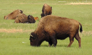
We saw numerous elks during the tour, and several herds of bison. The mothers have calves with them currently, called ‘red dogs’, same size as cattle calves. The male bison tend to keep to themselves. An occasional bighorn sheep was seen plus a  few small mammals such as pika and a few birds. 

  There are several waterfalls in the park, e.g. Gibbon Falls, and Lower & Upper Falls on the Grand Canyon of Yellowstone.


 Our lunch stop was at Canyon Village, where there was an excellent museum and visitor centre explaining the geology of the park. The area is the site of previous huge volcanic eruptions in the last 3 million years. The last, 650,000 years ago formed the caldera that is today the Yellowstone plateau. There is a large magma chamber at depth which causes the ground to uplift, and generates the geothermal features.  Our day was planned around seeing Old Faithful erupt, which occurred around 3.15 (every 90 minutes for about 3-4 minutes). It was well worth seeing.


After that we visited Lower Geyser Basin to see hot springs, mud pools and steam vents.  The weather was cool, with cold winds and the occasional snow flurry. We drove over 100 miles.

Tuesday was an early start but promising with bright sunshine.  We retraced our steps into Yellowstone, turning south to see The Great Prismatic Spring in the Midway Geyser Basin.  On this route we crossed the Continental Divide twice – this is the watershed dividing waters draining into the Pacific Ocean from those draining to the Atlantic – not always as straightforward as you might think! Then we headed some miles south towards Snake River, Jackson Lake and into Grand Teton National Park.

 This is a sight I will never forget. The mountains  (Grand Teton 13,770 feet) have been uplifted and have jagged outlines like the Alps of Europe, with evident features of glaciation. They rise up from Jackson Hole in a straight line for several miles with no foothills, along a fault line marking their eastern margin. The views are mesmerising. Again, there were good facilities for information and for refreshments along the way.

We reached Jackson mid-afternoon. It is a pleasant tourist town, playground of the rich and famous, especially for skiing. After a brief recce, we were off again for a Western-themed evening – a wagon ride to a camp cookout and dinner, followed by musical entertainment. The stars of the show were the horses – two to each of the nine wagons, each carrying about 20 people. It is a family business, well organised, and made for a memorable evening.

Monday 3 June 2013

Buffalo Bill and the West

Sunday 2nd June – The day started fine and almost as soon as we left Sheridan we started climbing up the Bighorn Mountains. This is a range of mountains running NW-SE for 200 miles east of the Rockies. They are made up of Bighorn National Forest and wilderness area, up to 13,000 feet. Along the roadside we saw rock exposures of contorted sediments, often, including the Permo-Triassic Goose Egg Formation. As we travelled west, we moved further down the geological succession.  We descended through the Shell River Canyon and stopped at Shell Falls. 

Here the river had cut down into the Precambrian basement granite and formed a gorge. All around us were towering peaks and precipitous crags. The dominant strata here were the Bighorn Dolomite and younger Madison Limestone.

At the bottom of the canyon there was a change to red horizontal sediments, marking a fault. We called at a roadhouse, Dirty Annie’s, to partake of her fruit pies – 10.30 am! Then we crossed the Big Horn River at Greybull, and then the Bighorn Basin, arriving at the town of Cody at 12.30.

This town is a gateway to the Rocky Mountains. En route we watched a DVD about the life of ‘Buffalo Bill’ Cody whom the town was named after. Cody started his career in the late 1860s as an army scout in the frontier region.  Encounters with Indian tribes followed and Cody later used these experiences to establish his Wild West shows. In 1888 he took his show and entourage of 200 players, including Annie Oakley to England and spent the next five years touring Europe. By 1893, the frontier was considered obsolete with no new lands to discover.
In the town of Cody we visited the Buffalo Bill Historical Centre which belies its name. It is a modern, spacious museum with sections dedicated to natural history and the Yellowstone area, the life and times of Buffalo Bill, Plains Indians culture, firearms and modern art. Our two-hour stay was inadequate.

After Cody, we drove past Buffalo Bill Reservoir, and into Shoshone Canyon. More amazing rock formations greeted us in red sediments, many of them with names such as ‘Holy City’, ‘Chimney Rock’ and so on.

This route led us to the east entrance to Yellowstone National Park. We had a journey of 80 miles to reach our hotel on the west side. Driving on park roads is slow; this is for the safety of wildlife, and there are frequent stops to take photographs. We saw some elk and a maternity herd of mother and baby bison close. 

We reached West Yellowstone at 6.30 pm. This is a typical tourist location with plenty of hotels, restaurants and shops.

Sunday 2 June 2013

Deadwood and Live Geology

We left Rapid City rather too rapidly – 8 am again! The reputation of our breakfast café had spread, so there was a long queue and we didn’t get our food until 7.45. Not the day to order pancakes layered with apple, but it all went in a box to take with us on the coach.
We made our way north on Interstate 90, through the Black Hills, a very scenic area. We took a slight detour to enable us to visit Deadwood, a town famed for its gambling establishments. It has an attractive main street of stone and brick buildings rebuilt after a devastating fire in 1879 which affected much of the town.


From here we drove East and back into Wyoming, the country flattening out a little, with some notable landforms. The geological structure of the Black Hills is an eroded dome with an exposed core of granite, seen earlier at Mount Rushmore. This is surrounded by a limestone plateau, and an oval-shaped hogs back of red Dakota Sandstone which we followed for miles. Our next stop was the amazing Devil’s Tower, a pinnacle of intrusive igneous rock rising 865 feet from its base. The columnar structure was caused as the molten rock cooled, and the tower has been exposed by the erosion of overlying rocks. It is a site of legend and prayer for Indian peoples. Protected by the National Parks Service, the surrounding woods are a haven for flora and fauna, and we enjoyed a 1.3 mile walk around the base of the tower. 

Another attraction on our way back to the road was a town of prairie dogs – very active until they heard us coming!  Our journey continued west across the Thunder Basin via Gillette. This was typical plains country – undulating grasslands with exposures of buff bedded rocks, no trees, few dwellings, cattle  and pronghorns. By 4 pm we could see the Bighorn Mountains, our destination for the following day. Out hotel for the night was the Holiday Inn in Sheridan. We were tired, so we didn’t explore far from the hotel, only next-door to a huge 24-hour Walmart.

Friday 31 May 2013

Crazy and More Rush

Friday 31st May –last night we stayed in Rapid City, South Dakota, a pleasant town with a definite main street. Despite the wind, we looked around for a while before choosing an interesting restaurant with Californian-European cuisine.
 Before our 9 am start today we managed to get a cheap and tasty breakfast in a café one block away (hotel restaurant rather on the elaborate side).  We left our central location and drove south into the Black Hills. These are named for their dark green, coniferous forest and rugged terrain of granites and metamorphic rocks, reminiscent of parts of Scotland. The area has a rich history of Indian settlement, and mining (Gold Rush) and is now a popular tourist location.
Two impressive attractions awaited us. First, we went to Crazy Horse, the world’s largest rock sculpture and national memorial to the Native American peoples.  This was designed in 1947 by sculptor Korczak Ziolkowski who worked on it until his death in 1982. The statue will be about 250 feet high when finished and has involved the removal of millions of tons of pink granite, a truly awe-inspiring achievement.  Work continues by a non-profit foundation run by his widow and 7 of his 10 children. The sculpture depicts Sioux Indian Crazy Horse, who was stabbed at Fort Robinson in 1877 by an American soldier while under a flag of truce. There is a large visitor centre, Native Indian museum and collection of work by Ziolkowski. See www.crazyhorsememorial.org.


 Pushed for a time and having barely done the place justice, we continued to Mount Rushmore in the same area. This is another rock sculpture, of the heads of former presidents Washington, Jefferson, Roosevelt and Lincoln, again in granite, but on a completely different scale – the heads being 10s of feet high and completed in a few years before 1941. (Remember the scene in Hitchcock’s film North by North-West?) This was designed by Gutzon Borglum, assisted for a short time by a young Korczak Ziolkowski. This is national monument and has the dignity and structure appropriate to such a construction.


The visit was marred by ferocious winds again, and as we left the site, rain began to fall. We returned to Rapid City and here some of the party continued on the optional visit to the Badlands National Park, about 90 miles to the south-east. Briefly we debated if it was worth pressing on with the trip in driving rain and poor visibility, but some time later our persistence was rewarding by yet a third incredible sight in the same day. The Badlands are a receding front of sharply eroded buttes, pinnacles and spires of multi-coloured sandstones and siltstones, marking the boundary between the high and low prairies.

 Despite the bad weather, there was plenty to marvel at, as we called at the visitor centre and took the 30-mile scenic drive. It was 7 pm before we returned to Rapid City after a remarkable day, certainly a highlight of our tour. Another early start tomorrow and back into Wyoming.

Rockies and Fort Laramie

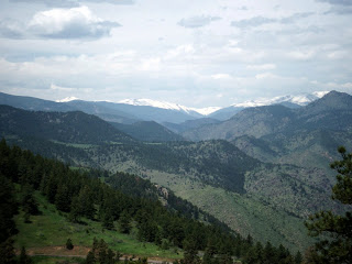
On Day 3 (29/5) we departed our hotel in Denver at 8 am in light rain. We drove North along the I25 as far as Loveland, and then turned west where the scenery became more interesting. Flat-lying sedimentary rocks changed to steeply dipping slates as we entered the impressive, winding Big Thompson Canyon. The vegetation was varied – pine, spruce, silver birch and aspen with leaves just breaking. The rocks changed again into gneisses and finally granite. 


Our first stop was Estes Park, at 7500 feet altitude, the gateway to the Rocky Mountains National Park. A park in this area refers to a flat area between peaks. Many of the peaks in the park are over 14,000 feet (3 times the height of Ben Nevis). Even at ground level here we noticed the effects of altitude – shortage of breath and a slower pace of movement. Many of the access roads are only seasonal and still blocked by snow. We returned to Estes Park, a pleasant town of 6000 people with the usual services and gift shops, for lunch and met this fellow on the way.


We returned down the winding gorge to Loveland, and spent the remainder of the afternoon on the journey North to Cheyenne, just into Wyoming. We stopped at a visitor centre to stock up on maps and information leaflets. Our hotel for the night was Little America, a country-club style establishment with a golf course, and Tony promptly went for a swim in the outdoor pool – sunny but breezy.


Day 4, Thursday, dawned sunny but windy, another 8 am start. En route we stopped at a supermarket in Cheyenne to buy a picnic lunch for our visit to Fort Laramie. The Great Plains landscape was evident on this part of the journey – gently undulating grasslands with occasional bluffs or outcrops of pale rocks ((siltstones?), occasional grazing cattle and pronghorns, a type of wild antelope. We drove North again on I25 and then turned East on to I26 to Guernsey, a small garrison town on the North Platte River. Mid-morning we stopped at the nearby Oregon Trail Ruts, a national historic landmark. These are remnants of the original ruts worn in the bedrock by wagons of the pioneers and settlers migrating to the West, in the mid-19th century.  There were camps in this area where settlers found a way across the river. From here we soon reached Fort Laramie (not to be confused with Laramie), another historic site close to the junction of the Laramie and North Platter Rivers. Originally set up as a trading post, Fort Laramie was a government post from 1849 to 1890, and saw many movements of people travelling west, as well as conflicts with the native Indian peoples. Today it consists of some ruined buildings and some reconstructed, such as the cavalry barracks and the captains’ house. Although a very interesting site, the visit was marred by what can only be described as vicious winds!


The afternoon was spent driving in heavy rain into South Dakota and towards the Black Hills along I79. Our stop for the next 2 nights is the Adoba Eco Hotel in Rapid City, another windy location! The weather forecast for the next few days does not look good.

Tuesday 28 May 2013


Hi there folks. Our trip started on Monday 27th May with a comfortable mid-morning car journey to London Heathrow, courtesy of Titan Travel. We jetted off around 4.30 pm on British Airways to Denver, a flight of around 9 hours 40 minutes, passed by various complimentary drinks, snacks and movies. On landing in Denver, with a backdrop of the Rockies, we queued for an hour to get through immigration and then met up with our tour manager and group.  We had a half-hour drive through the dusk, to reach the city of Denver and our hotel, the Sheraton Downtown.  After navigating the vast marble halls and corridors of this conference hotel, we found our room about 9.30 pm local time (7 hours behind UK time, equivalent to 4.30am!). A quick sortie into the local precinct revealed most cafes to be closed, even Starbucks, so after a quick drink, we were glad to retire for the night.
Tuesday dawned warm and sunny. A hearty breakfast buffet in the hotel made up for the deficiencies of the evening before. Our morning coach tour took us around the Lower Downtown area (LoDo) and to the State Capitol building. Famed for its dome coated in gold leaf, the roof is currently swathed in scaffolding and white polythene undergoing renovation. The famous ‘mile high’ altitude of this city is measured at the thirteenth step at the front of the building.  We had a short visit around this area, marked with various national monuments.
From the steps of the Capitol Building
 Then we headed out of town west towards Golden (site of the 19th century gold rush) in the foothills of the Rockies. We noted various geological and landform features of interest en route. Our destination was Lookout Mountain, a natural viewpoint and site of the burial in 1917 of ‘Buffalo’ Bill Cody, who spent the last years of his life here. The town of Cody, in Wyoming, is still trying to claim back his body!

In the afternoon we took the free electric bus down the adjacent 16th Street Mall. This is a tree-lined pedestrian precinct of shops, bars and restaurants leading north-west to the South Platte River on which the city was founded. Here we found pleasant parks, walkways and cycle trails.


After a welcome siesta in our room (jetlag beginning to register), we sauntered out to dinner at Maggiano’s, a nearby atmospheric Italian restaurant (can’t face those 12 ounce steaks yet!). Thus finished a pleasant day in Denver, a modern, clean and stylish city. Tomorrow we depart at 8 am!

Sunday 19 May 2013

The grand tour of the Rocky Mountain National Parks

Sunday, 19th May 2013

Major effort - set a blog!

So one week to go and things are getting into gear.

Passports and tickets checked;
Visa courtesy of ESTA - very pricey;
Packing list - checked and approved (after 3rd edition);
Extracted current temperatures at forthcoming locations - pretty cold 
10 Centigrade!  Revise packing list - edition 4.


Some of Dakota's badlands taken on a previous visit


Small mountains in a semi-arid landscape


A nice vegetation sequence

So the next blog will hopefully be from Denver